May 3rd 2014 was the international SOTA day, and it felt like a good idea to celebrate it by activating a few summits. This time, I tried exploring a part of my country i’ve never visited before, the Macin Mountains, not far from the Danube’s Delta. These are some of the oldest mountains in Europe, appeared around 300 milion years ago in the Hercynian orogeny and were once over 3000 meters high; but Mother Nature being herself, constant winds and temperature differences slowly eroded the tall and proud rock giants down to only a few hundred meters. The area is the home of superb biodiversity wich would deserve a few days on it’s own – not to mention the hystorical attractions in the area, but since I only had one day, SOTA was the main focus.
To get to Macin Mountains we had to cross the Danube by ferry at the city of Braila – near the Great Braila Island, and then drive alongside an almost poetic area of water flooded forest.


Passing trough the small city of Macin, we arrived at the village of Greci (yes, it means Greeks) and soon we’re at the base of the Tutuiatu peak (467m, YO/MM-001), with the sun smiling down upon us in the fresh morning air.
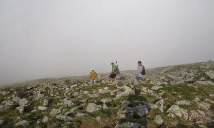
The markings quickly disappeared and we had to go by instinct, trying to reach the ridge and follow it to the top.


The presence of rocks on mountains this small almost gives you the gut feeling this place is really old, feels like no other place i’ve seen before.

As soon as we reach the ridge we can see the modern man has taken interest in this place as well: there is a rock quarry just on the other side of the mountain.

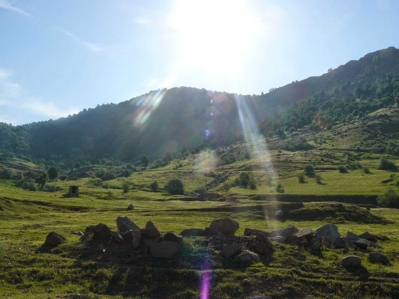
Looking back at where we came from, we see the village of Greci in the morning sun from up here, with the fog not totally lifted yet. In distance, the Iacobdeal Peak (YO/MM-005), my second target for the day.

The mountain quickly becomes steep but luckily we find an unmarked bypath wich was going up.

Soon we reach a small plateau – a real belle view point where the girls just had to take a picture.

After some back and forth – because of a steep downhill portion we thought the path wasn’t going to the top and we tried alternatives, the help came over radiowaves from the great guy Florin YO8SDE (thanks!). He was in the area, had a mountain map and after giving him our GPS position he confirmed the path going downhill was the way to go. After just a few minutes of hiking the barren rocky land changed for vivid vegetation – it was literally just around the corner !


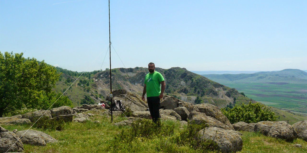
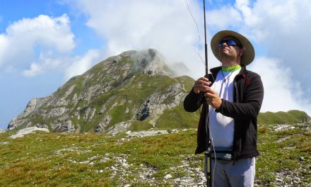
But hey, 10 more minutes and we are on the top – rest for a few minutes, grab a quick snack and get on the radio.

The bands are alive, I only get the chance to work on 20m (71 contacts), 15m (2 contacts) and 2m (4 contacts) in the one hour i’ve decided to stay on the top, gladly giving out the new peak in the log to alot of SOTA afficionados.

The equipment was the usual:
– Yaesu FT-897D
– LDG Z-100Plus
– 12V/7Ah SLA
– fishpole vertical, 9:1 UnUn

The next part of my day was activating the YO/MM-005, so I didn’t have enough time to enjoy the nature. Still, this area is part of the Macin Natural Park and is registered in the World Flora Fauna program under YOFF-009, so you might guess there is some really interesting fauna you can run into:


Logs are uploaded under YO9IRF/P to LOTW, eQSL, SOTA, HRDlog, QRZ.com, Enzolog and are good for both SOTA and WWFF programs.


Great story and beautiful photos. Thanks…73, Bas
Thank you Bas !
Excellent story, good photos, Razvan! And of course, nice SOTA activations. Must say it: Bizzu like this, hihi!